 Coach
Palaeogeography is the reconstruction of the geography of a past time: the positions of the continents and oceans, and of their shorelines, mountain belts and seas. A palaeogeographic map shows that geography at one time, on the grid of latitude and longitude of that time.
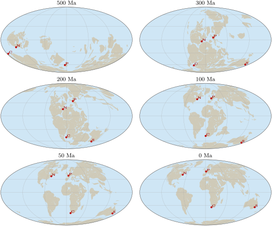
Examples
Example 19.2 (Paris drifts north)
In the model, Paris lay at N ago; it lies today at N. Its latitude has grown by , that is along a meridian ( per degree on a sphere of radius ), at a mean rate of per million years, or a year. This is only the northward part of the motion: the palaeomagnetic frame leaves the longitude free, so the true distance travelled was at least this.