All books

Professional

Apps About Coach Log in Start reading

Earth and Space Sciences · Glossary

What is Stable air; unstable air?

Also known as: stable air · unstable air

Definition 4.10 High School Earth and Space Sciences · Chapter 4 — Why Clouds Form

Air is stable when a parcel pushed upwards becomes colder than the air around it, and so sinks back to where it started. It is unstable when the parcel becomes warmer than the air around it and keeps rising on its own.
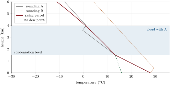
A parcel rising from the ground at 28 C with a dew point of 16 C (computed): it cools at the dry rate until its temperature meets its dew point at 1.5\, km, then at the slower saturated rate. Two invented soundings: in A, the parcel is warmer than its surroundings from 1.5\, km up to the warm layer near 4\, km, and a cumulus grows between them (shaded); in B, warmer air above the ground keeps the parcel colder than its surroundings everywhere: stable air, no cumulus.
A parcel rising from the ground at 28∘C28{}^{\circ}\mathrm{C} with a dew point of 16∘C16{}^{\circ}\mathrm{C} (computed): it cools at the dry rate until its temperature meets its dew point at 1.5 km1.5\,\mathrm{km}, then at the slower saturated rate. Two invented soundings: in A, the parcel is warmer than its surroundings from 1.5 km1.5\,\mathrm{km} up to the warm layer near 4 km4\,\mathrm{km}, and a cumulus grows between them (shaded); in B, warmer air above the ground keeps the parcel colder than its surroundings everywhere: stable air, no cumulus.
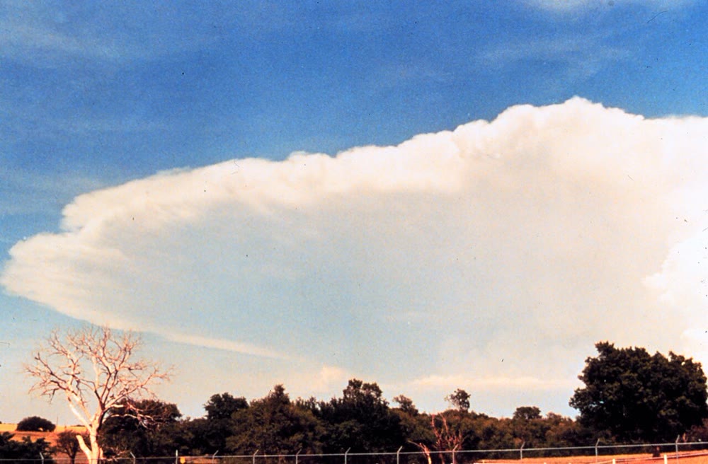
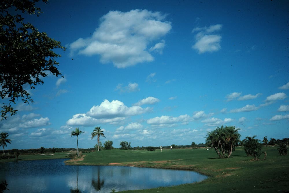
Left: fair-weather cumulus over Florida, with flat bases at their condensation level. Photograph: Ralph F. Kresge, NOAA (public domain). Right: the anvil of a cumulonimbus in the early stages of a storm. Photograph: NOAA National Severe Storms Laboratory (public domain). Left: fair-weather cumulus over Florida, with flat bases at their condensation level. Photograph: Ralph F. Kresge, NOAA (public domain). Right: the anvil of a cumulonimbus in the early stages of a storm. Photograph: NOAA National Severe Storms Laboratory (public domain).
Left: fair-weather cumulus over Florida, with flat bases at their condensation level. Photograph: Ralph F. Kresge, NOAA (public domain). Right: the anvil of a cumulonimbus in the early stages of a storm. Photograph: NOAA National Severe Storms Laboratory (public domain).
Read in context →