Primary & Middle School Earth and Space Sciences · Grades 1–9
6The Globe: Continents and Oceans
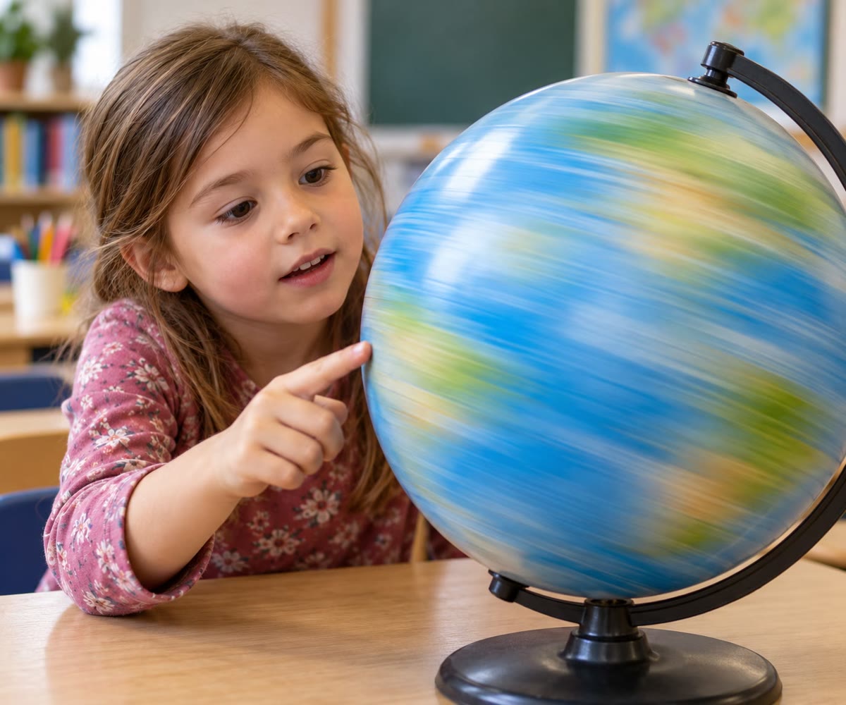
In Lena’s classroom there is a globe on a stand. Lena closes her eyes, spins it with one finger, and stops it with the tip of her finger. She opens her eyes: her finger is on blue, in the middle of an ocean. She tries again: blue again. The third time, she lands on yellow-green, somewhere in the middle of Africa.
Lena keeps playing, and counts. Her finger stops on the sea much more often than on the land. Why? And what are all those shapes of land and of water that turn under her finger?
You already know
Most of the Earth is covered by salt water: about 71 squares out of 100 on the grid of Chapter 3. An ocean is a very large stretch of salt water between the land masses; a sea is a smaller one, at the edge of an ocean. A map is a drawing of a place seen from above, made smaller (Chapter 4). The physics books tell how the Earth turns on itself once a day, which gives us day and night.
6.1 The globe, a small model of the round Earth
The Earth is round, like a very big ball. We cannot see its shape from the ground, because it is far too big: wherever we stand, the ground looks flat. But astronauts who travelled far from the Earth saw it whole, a round blue ball in the black sky (the photograph at the start of Chapter 3).
To see the whole Earth in a classroom, we make it small.
Definition 6.1 (Globe)
A globe is a model of the Earth: a ball on which the land and the oceans are drawn with the same shapes as on the real Earth, only very much smaller.
A globe is the best picture of the Earth, because it has the right shape: round. But like the real Earth, we can only ever see one half of it at a time. To see the other half, we turn it round.
Remark 6.2 (Two very different halves)
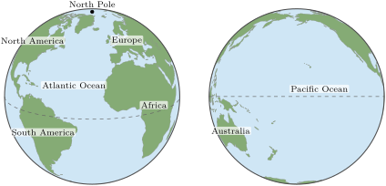
Look at the two pictures. On the left, land covers about 4 parts of the picture out of 10. On the right, only about 1 part out of 10: the Pacific side of the Earth is almost all water. If Lena’s finger stops on that side of the globe, it will nearly always land on the sea.
6.2 The equator, the poles and the two hemispheres
A globe turns on a rod that goes right through it, from top to bottom. The real Earth has no rod, but it also turns round a line through its middle. The two places where that line comes out of the Earth have names.
Definition 6.3 (Pole)
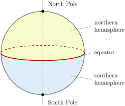
The North Pole and the South Pole are the two points at the very top and the very bottom of the Earth, where the line the Earth turns round comes out. Each of them is a pole. On a globe, the North Pole is at the top.
Definition 6.4 (Equator and hemisphere)
The equator is an imaginary line drawn all the way round the Earth, exactly halfway between the North Pole and the South Pole. It cuts the Earth into two halves, each called a hemisphere: the northern hemisphere, on the side of the North Pole, and the southern hemisphere, on the side of the South Pole.
The equator is not painted on the ground: no one can see it on a beach or in a forest. It is drawn on globes and on maps to help us find our way.
Example 6.5 (Hot near the equator, cold near the poles)
The lands near the equator are hot all the year round: that is where the great rainforests grow. The lands near the poles are cold all the year round, and much of them is covered by ice. You will learn in a later year why this is so; for now, remember: the closer to a pole, the colder.
6.3 Seven continents and five oceans
On a globe, the land is not spread out in little pieces everywhere. Most of it is gathered in a few very large masses.
Definition 6.6 (Continent)
A continent is one of the very large masses of land on the Earth, together with the islands close to it.
People most often count seven continents. From the largest to the smallest they are: Asia, Africa, North America, South America, Antarctica, Europe and Australia.
| Size | Continent | Hemisphere | A word about it |
|---|---|---|---|
| 1 | Asia | mostly northern | the largest |
| 2 | Africa | both | the equator crosses its middle |
| 3 | North America | northern | reaches far to the north |
| 4 | South America | mostly southern | the equator crosses its north |
| 5 | Antarctica | southern | around the South Pole, under ice |
| 6 | Europe | northern | joined to Asia on its east side |
| 7 | Australia | southern | the smallest |
Remark 6.7 (Where does one continent end?)
Some continents are surrounded by sea on every side, like Australia or Antarctica. Others touch: Europe and Asia are one single mass of land, and people chose where to draw the line between them. That is why some people count six continents, or even fewer.
Between the continents lie the oceans. There are five of them. The largest is the Pacific Ocean; then come the Atlantic Ocean, the Indian Ocean, the Southern Ocean around Antarctica, and the smallest, the Arctic Ocean around the North Pole. For a long time people counted only four; today most countries count the Southern Ocean as the fifth.
Example 6.8 (How big is the Pacific?)
The Pacific Ocean is so big that all the continents put together could fit inside it. It holds more than half of all the ocean water on Earth. That is why the right-hand globe in the first section of this chapter looks almost all blue.
Method 6.9 (Naming the ocean between two continents)
To find which ocean lies between two continents, put a finger on each of them on the globe, and turn the globe so that you can see both. The ocean your eye crosses to go from one finger to the other is the one between them. On a globe there are often two ways round: take the shorter one.
Example 6.10 (Africa and Australia)
Going from Africa east towards Australia, we cross the Indian Ocean. Going from Europe west to North America, we cross the Atlantic Ocean. Going from Asia east to North America, we cross the Pacific Ocean.
6.4 A world map is a flattened globe
A globe is round, so it is not easy to carry, and we can never see all of it at once. A map on a sheet of paper shows the whole Earth in one look.
Definition 6.11 (World map)
A world map is a map of the whole Earth drawn flat on a sheet of paper or on a screen, with all the continents and all the oceans in one picture.
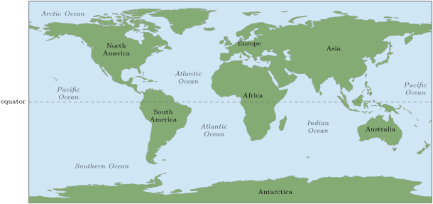
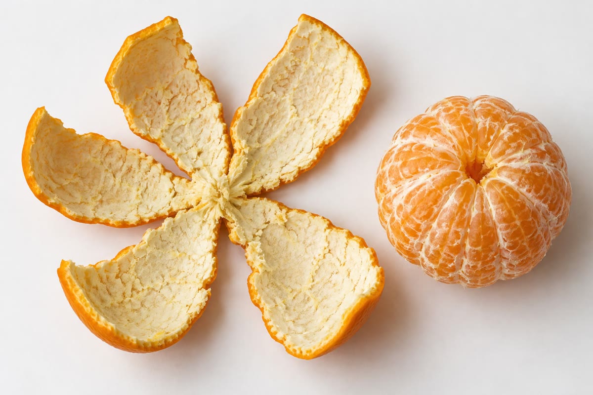
But there is a difficulty. Try to flatten the peel of an orange on a table: it cannot lie flat without tearing or stretching. The same happens to the surface of the globe when it is drawn flat. Every world map tears the globe somewhere, or stretches some places and squeezes others.
Remark 6.12 (The map and the globe disagree)
On this world map, Antarctica looks like one of the biggest continents, stretched along the whole bottom edge. On the globe, it is a round mass of land, smaller than South America. Near the poles, a flat map stretches the land a lot. Near the equator, it stretches it very little. When you want to compare the size of two places far from the equator, the globe tells the truth.
Method 6.13 (Reading a world map)
On a world map like this one:
- north is at the top, south at the bottom; the North Pole is the whole top edge and the South Pole the whole bottom edge;
- the equator is the line across the middle: everything above it is in the northern hemisphere, everything below it in the southern hemisphere;
- the left and the right edges are the same line on the globe: a ship that sails off the right edge comes back on the left.
6.5 Exercises
Exercise 6.1 ★
Name the seven continents. Which is the largest? Which is the smallest?
Solution
Solution of Exercise 6.1.
Asia, Africa, North America, South America, Antarctica, Europe and Australia. The largest is Asia; the smallest is Australia.
Exercise 6.2 ★
Name the five oceans. Which is the largest? Which is the smallest?
Exercise 6.3 ★
Copy and fill in with “North Pole”, “South Pole” or “equator”: the … is at the top of a globe; the … is at the bottom; the … goes all the way round the middle.
Solution
Solution of Exercise 6.3.
The North Pole is at the top of a globe; the South Pole is at the bottom; the equator goes all the way round the middle.
Exercise 6.4 ★
Northern or southern hemisphere? Europe; Australia; Antarctica; North America.
Solution
Solution of Exercise 6.4.
Europe: northern. Australia: southern. Antarctica: southern. North America: northern.
Exercise 6.5 ★
Which ocean lies around the North Pole? Which ocean lies around Antarctica?
Solution
Solution of Exercise 6.5.
The Arctic Ocean lies around the North Pole. The Southern Ocean lies around Antarctica.
Exercise 6.6 ★★
Which ocean do you cross to go from Africa to South America? From Australia to South America, going east? From Africa to Australia?
Exercise 6.7 ★★
Sam lives in a country where it is hot all the year round. Bo lives on a research station where it is freezing all the year round. One of them lives near the equator, the other near a pole. Who lives where?
Exercise 6.8 ★★
Lena spins the globe 10 times. Her finger lands on the sea 7 times. How many times does it land on the land? Is this what you expected? Why?
Solution
Solution of Exercise 6.8.
: her finger lands on the land 3 times. This is what we can expect: about 71 squares out of 100 of the Earth are water, so about 7 times out of 10 the finger stops on the sea. (With only 10 spins, she could also get 6 or 8: the count changes from one game to the next.)
Exercise 6.9 ★★
On the world map on page 37, the Pacific Ocean appears twice. Why? Does the real Earth have two Pacific Oceans?
Solution
Solution of Exercise 6.9.
To draw the world map, the globe was cut along a line through the middle of the Pacific Ocean and laid flat. One half of the Pacific ends up on the left edge of the map, the other half on the right edge. There is only one Pacific Ocean on the real Earth: the two edges of the map are the same line on the globe.
Exercise 6.10 ★★★
Tom says: “On the world map, Antarctica is longer than Asia, so Antarctica is the biggest continent.” Is Tom right? Use the list of the continents from the largest to the smallest, and say why the world map fools him.
Solution
Solution of Exercise 6.10.
Tom is wrong. From the largest to the smallest, the continents are Asia, Africa, North America, South America, Antarctica, Europe and Australia: Antarctica is only the fifth, much smaller than Asia. The world map fools him because a flat map stretches the land near the poles a lot. Antarctica, which lies around the South Pole, is stretched into a long band across the whole bottom of the map. On the globe it is a round mass of land, and much smaller than Asia.